
Roadway Asset Management
Map and Condition rate ALL your assets.
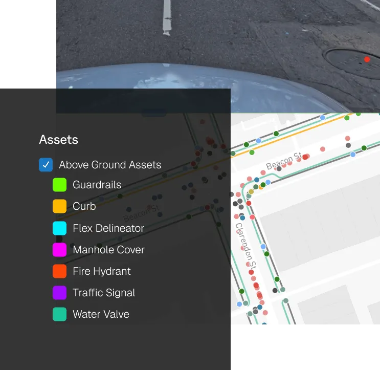
Map and Manage Assets - All in One Place.
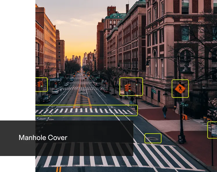
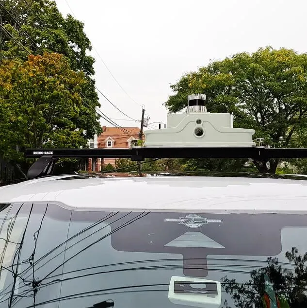
Survey your roadways at driving speed, then let the Cyvl algorithms detect, classify, locate, and condition assess 40+ transportation infrastructure assets-all in one easy-to-use digital dashboard.
Filter by:
- All
- Greenery and Landscaping
- Lighting Infrastructure
- Public Safety
- Roadway
- Traffic Management
- Utility
- Waste Management
- Water Infrastructure

Pavement Conditions

Traffic Signs

Markings & Striping

Benches

Bins

Public Art

Grated Gullies

CCTV Cameras

Complete Streets

Kerb Ramps

Kerbs

Fences

Fire Hydrants

Kerb Markings

Footpath Lighting Pole

Guardrails

Concrete Crash Barriers

Lighting Poles

Maintenance Hole Covers

Field Inlet Pits

Pedestrian Assets

Retaining Walls

Footpaths

Stormwater Entry Pits

Street Lights

Traffic Cones

Traffic Signals

Trees

Utility Poles

Water Valve Boxes
Digitise Your Roadway Assets.
Generate geospatial reports, take measurements in your web browser, navigate 3D interactive maps, and conduct Virtual Field Visits from anywhere.

Survey 10X Faster.
Capture comprehensive roadway asset data, then unleash the cyvl algorithms to detect, classify, locate, and assess 40+ infrastructure asset classes.
Future Proof Asset Management.
Digitise every detail including location, category, code and condition.
Case Study
OWN Success Story
Cyvl, in collaboration with OWN, Inc’s Destin, Florida office embarked on an innovative pilot project aimed at addressing infrastructure management for the WaterColor Resort, a 500-acre community in Walton County, Florida.
The project covered a span of 15 centerline miles, utilizing Cyvl’s advanced technologies and OWN’s expertise to detect and document a comprehensive range of above-ground assets and roadway data.

Contact us
Suite 34, Darwin Innovation Hub,
Level 1, 48-50 Smith St Mall,
Darwin City NT 0800,
Australia
0427 142 252
